We are consulting on our Active travel network map and would like to hear your thoughts. This is a 15-year plan for improving routes for:
- walking,
- wheeling, and
- cycling.
The plan involves existing routes and proposed future routes.
Why we are consulting
Our existing Active Travel Network Map was approved on 1 December 2022. Under the Active Travel Act, we must update this regularly and submit our updated version to the Welsh Government on 1 December 2026.
Your responses can help us:
- get feedback on existing routes, and
- make sure that proposed future routes are serving people's journeys.
What we are proposing
Updates to our Active Travel Network Map would show:
- Routes built since 2021 removed from 'future routes' added to the 'existing routes' map
- Reviews of future routes, in line with policies and plans developed since 2021
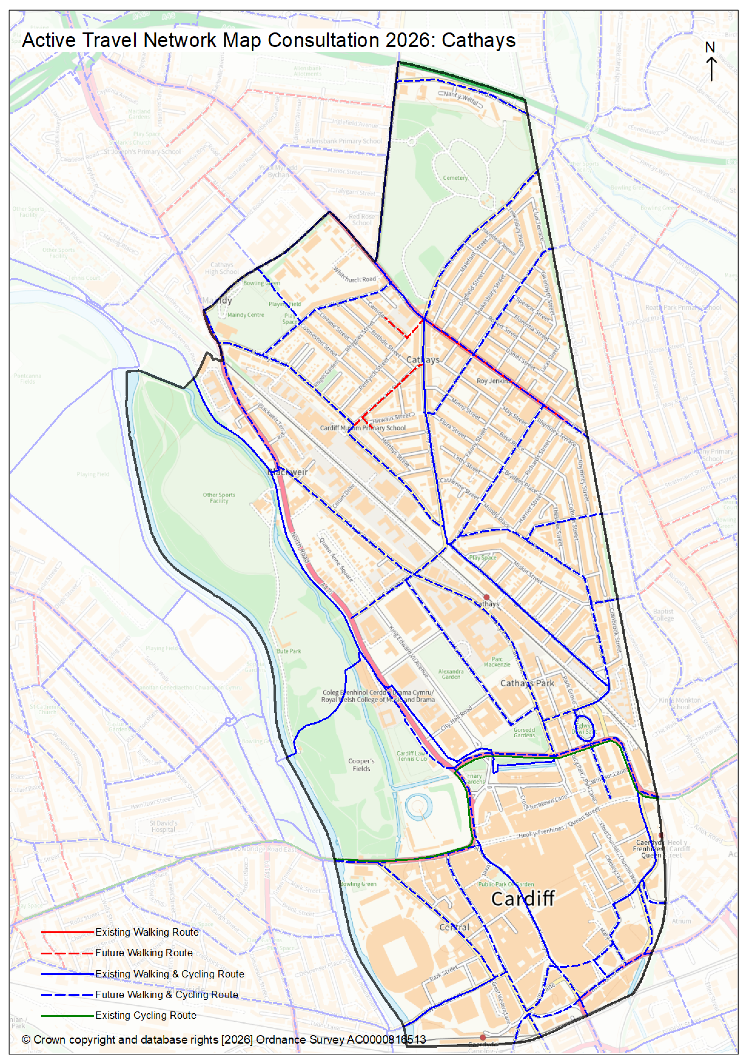
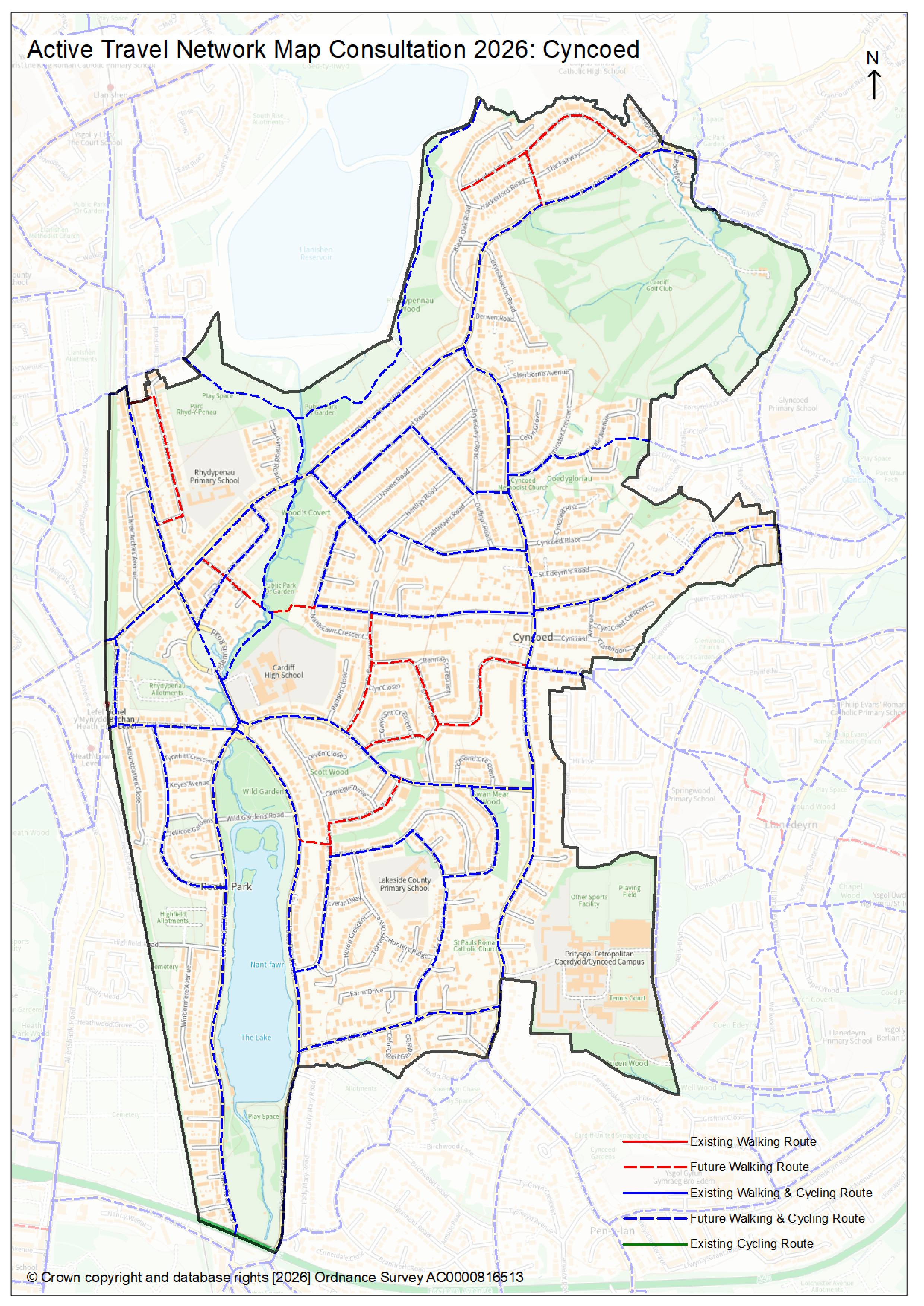
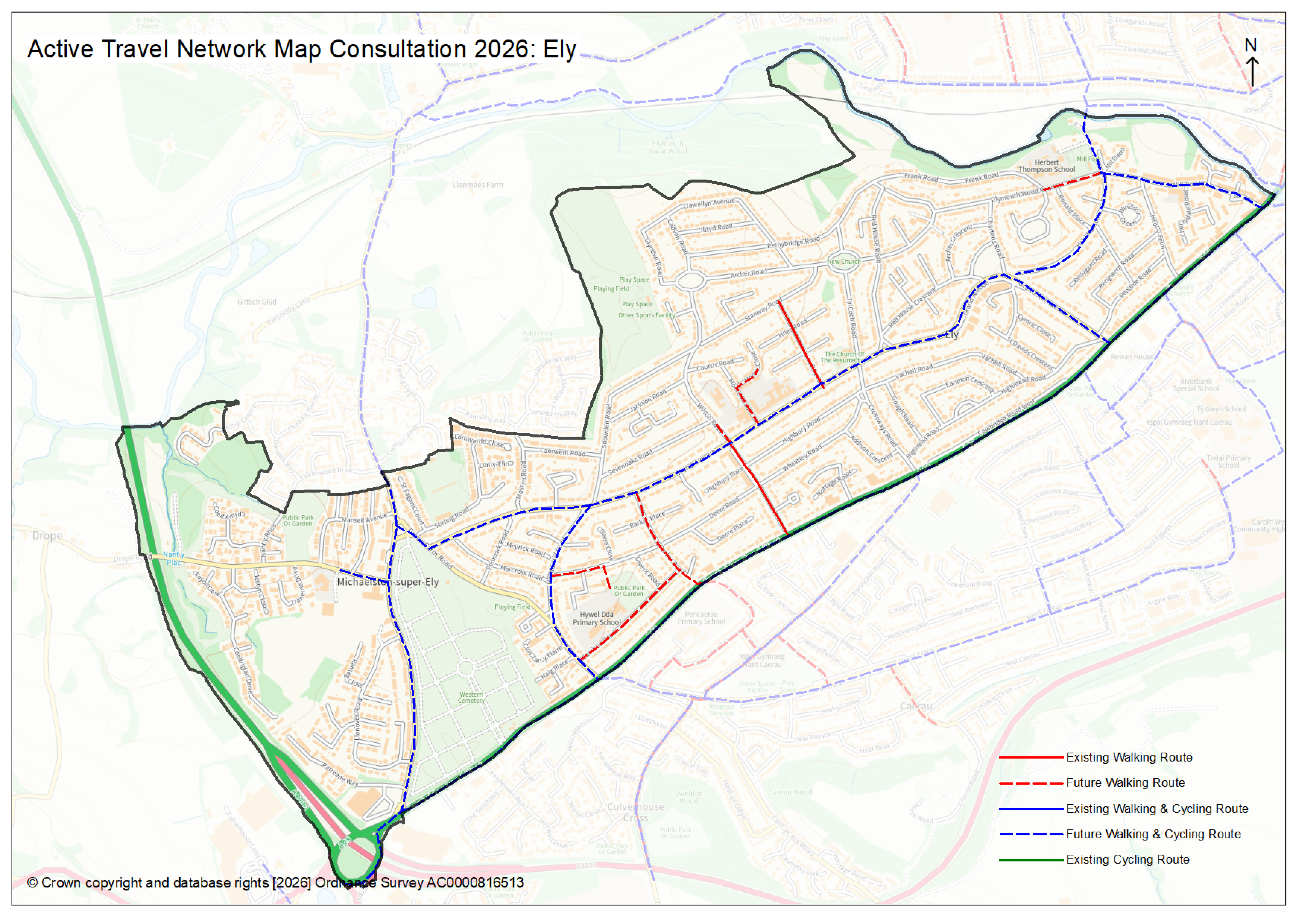
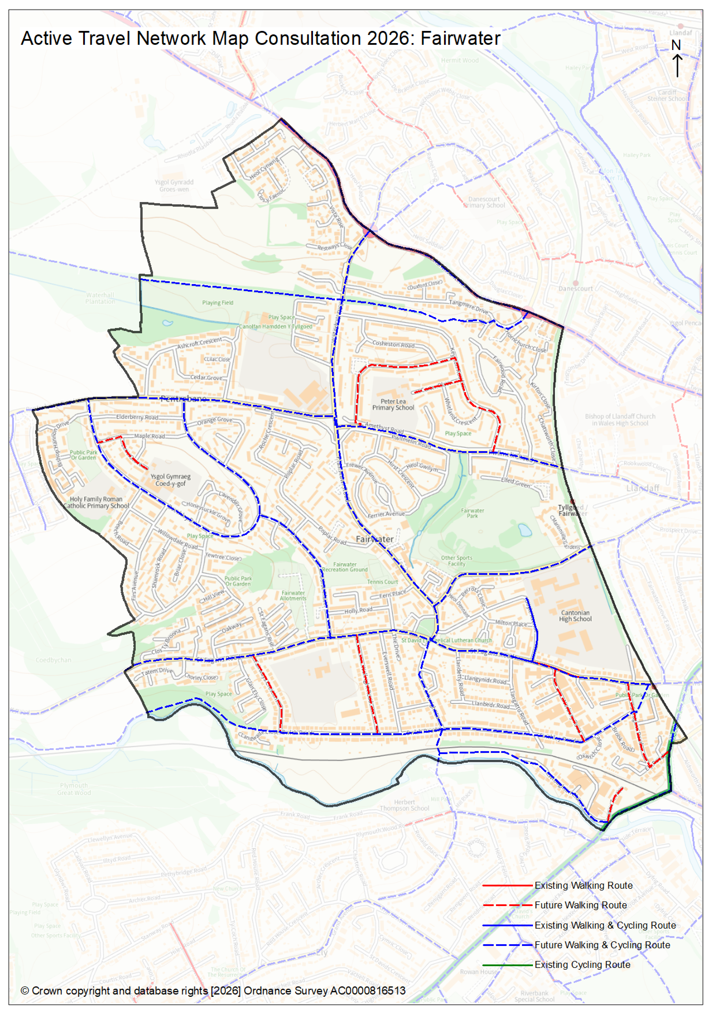
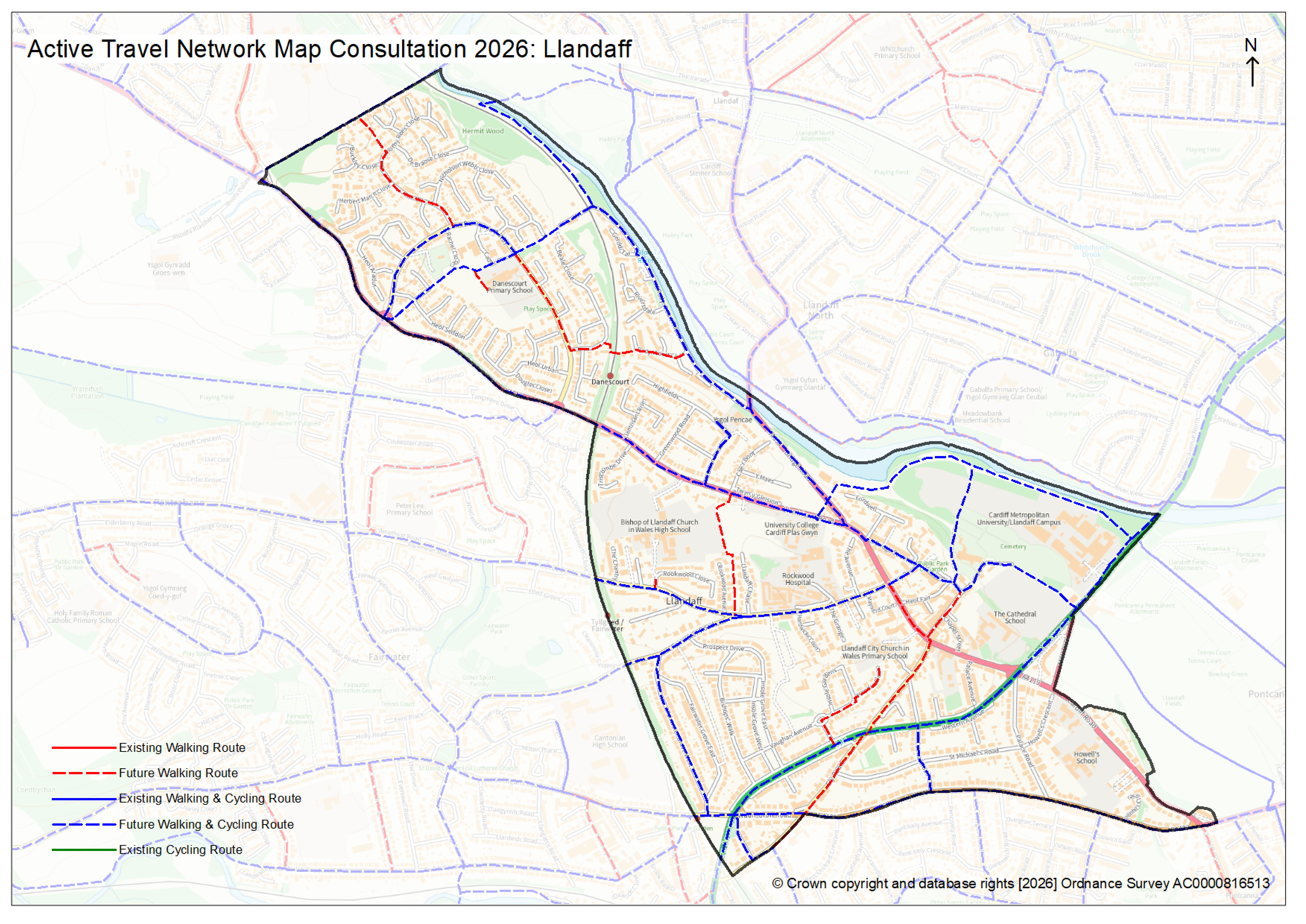
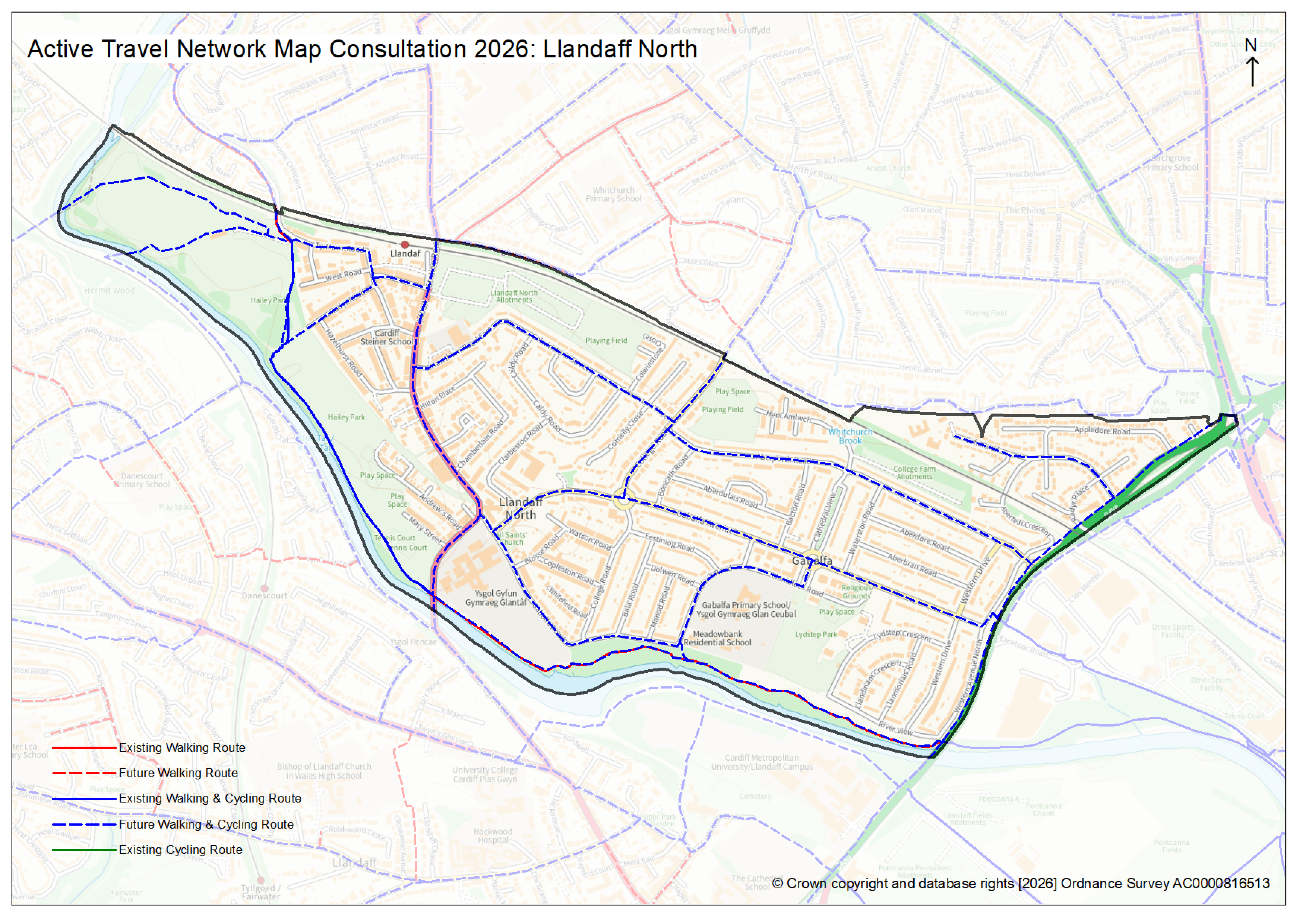
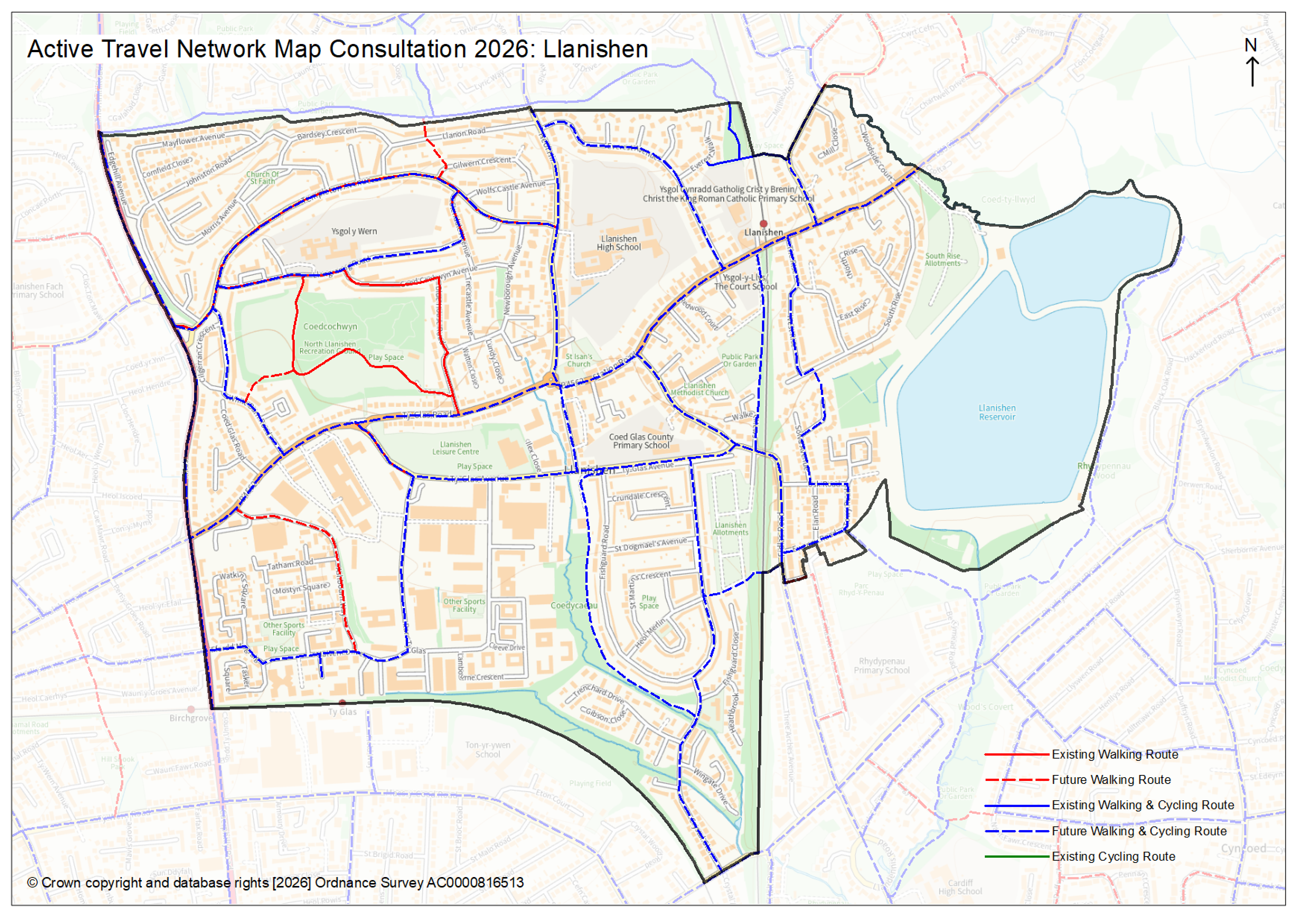
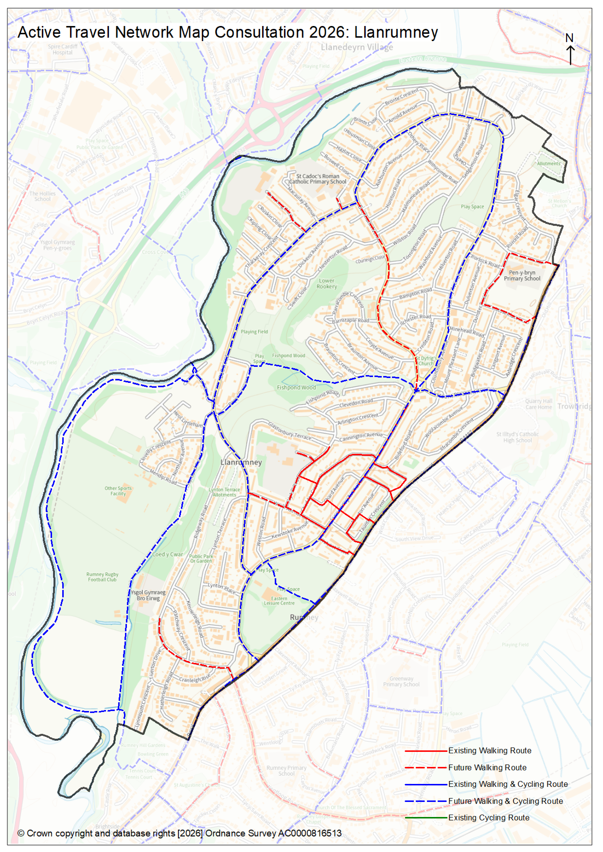
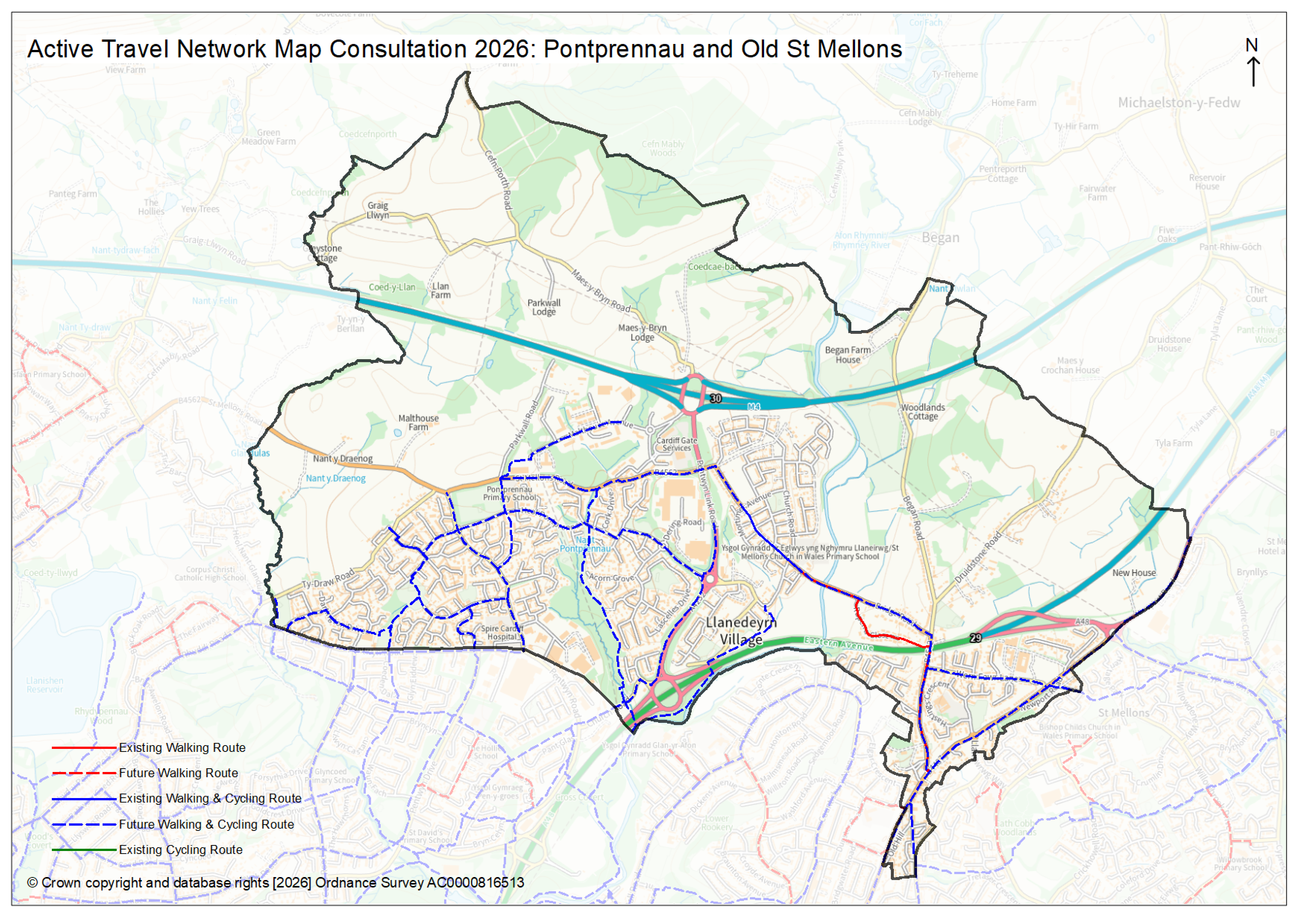
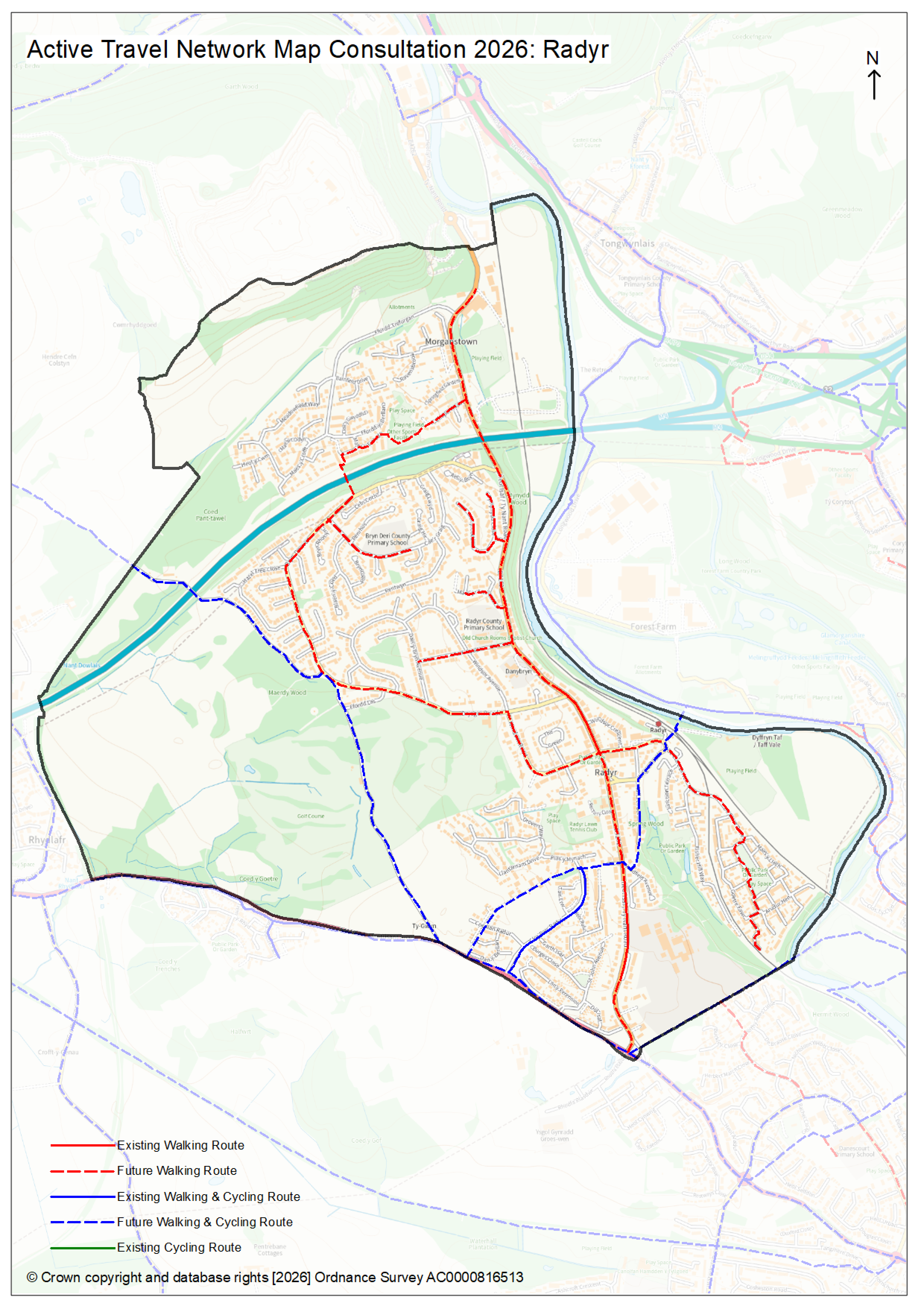
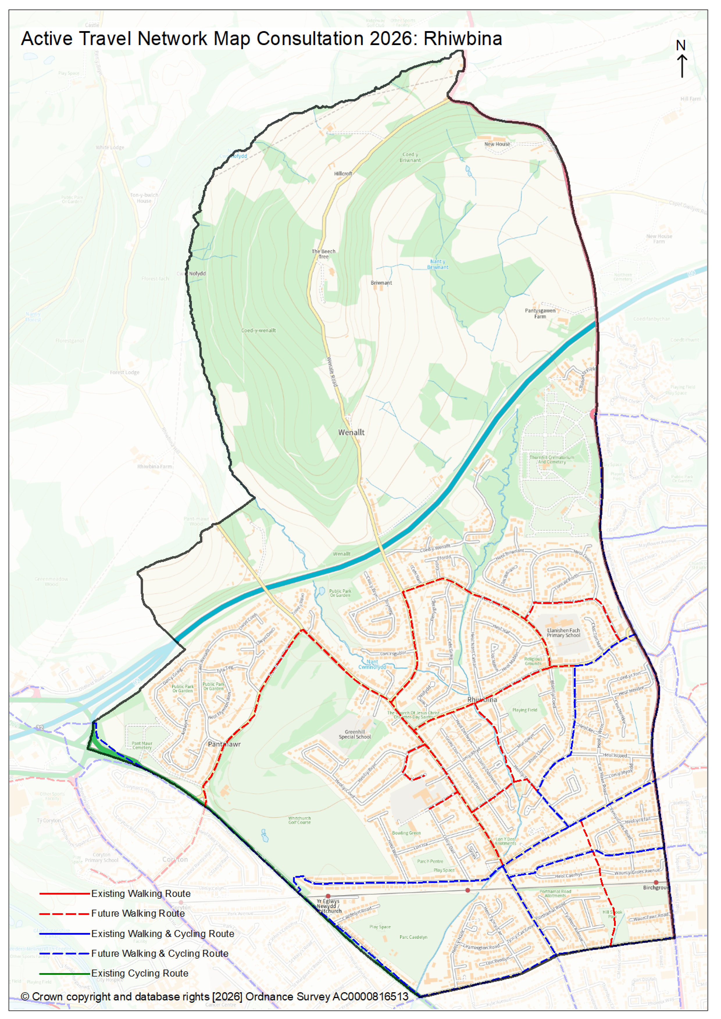
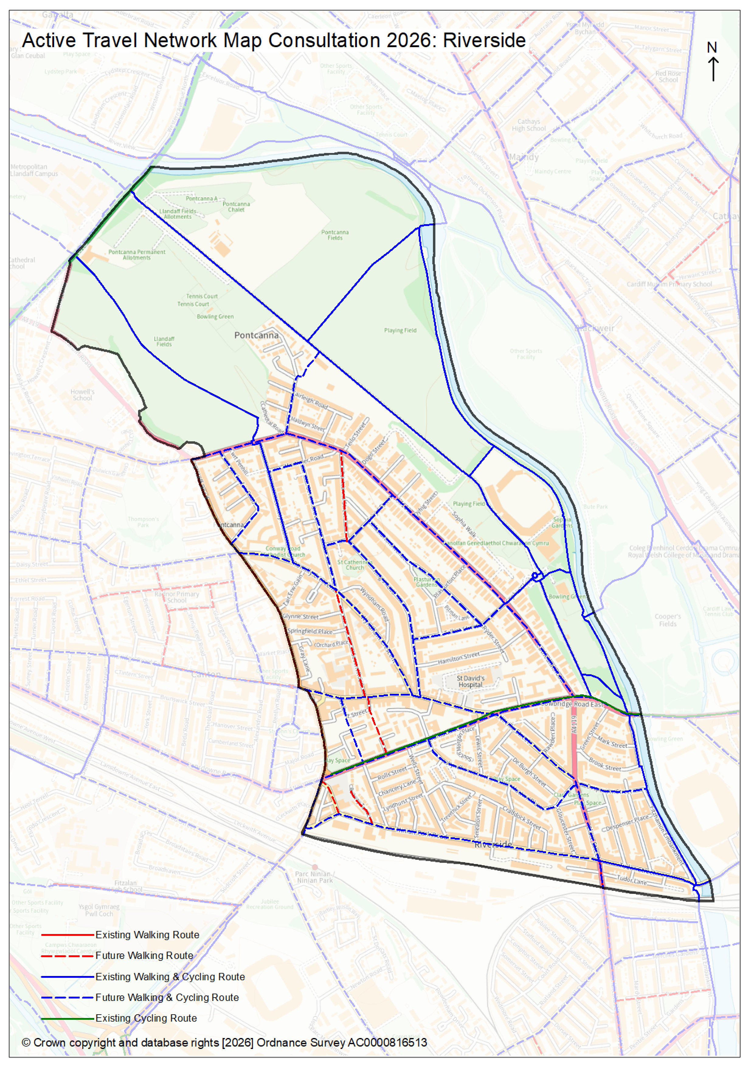
Active Travel Network Maps by ward
Check your ward's current Active Travel Network Map to find out more.
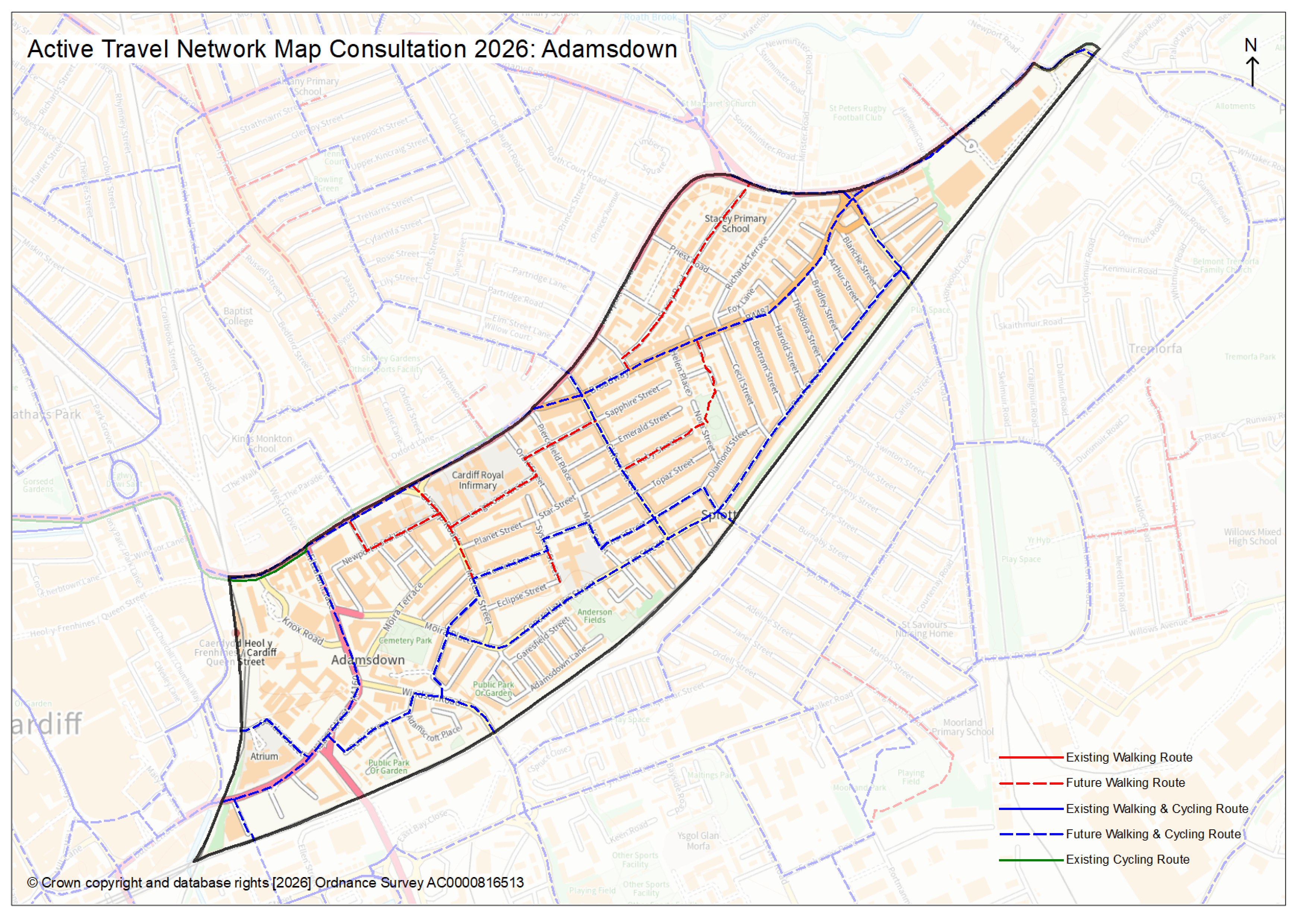
- Adamsdown (2mb PNG)
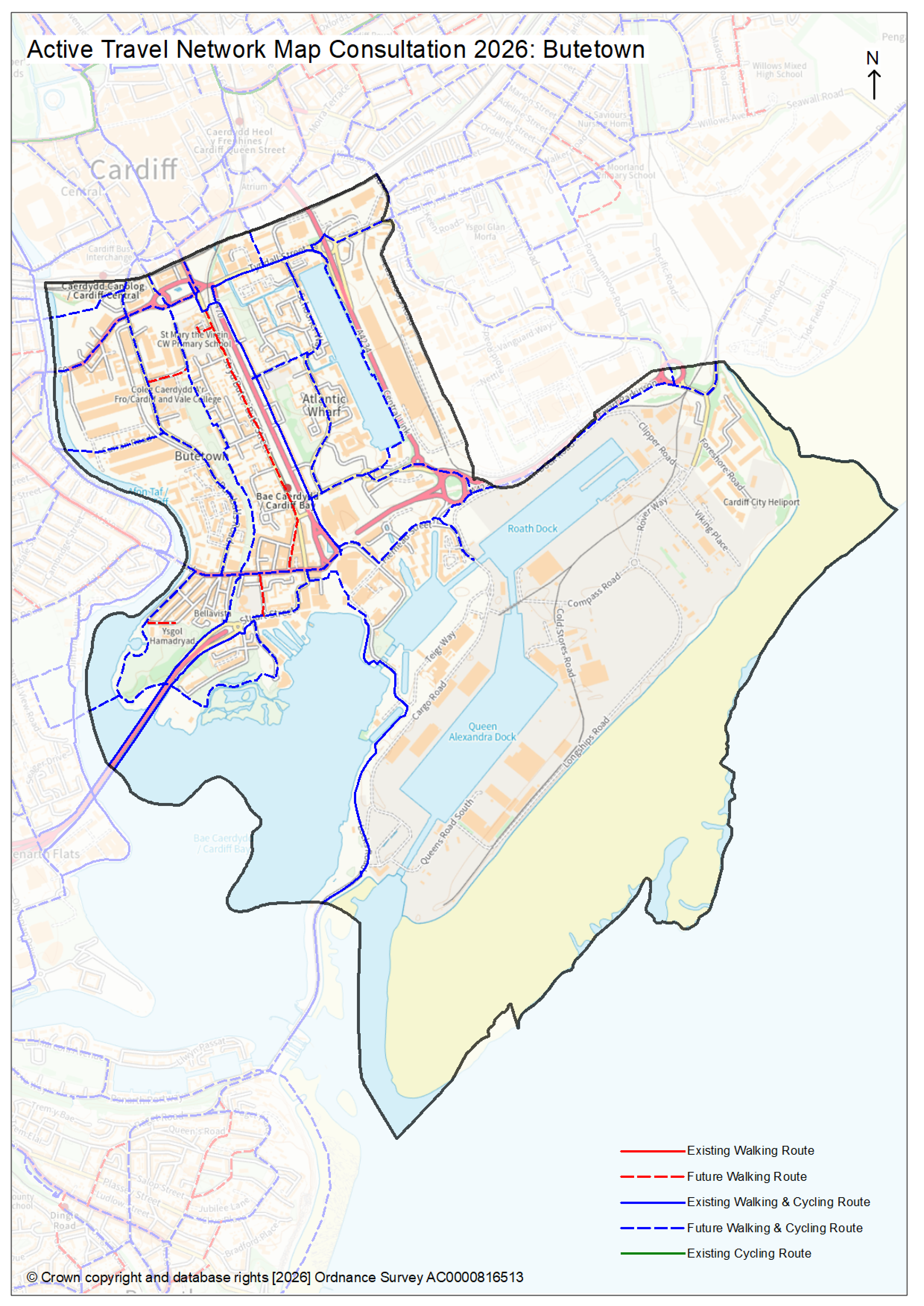
- Butetown (1.9mb PNG)
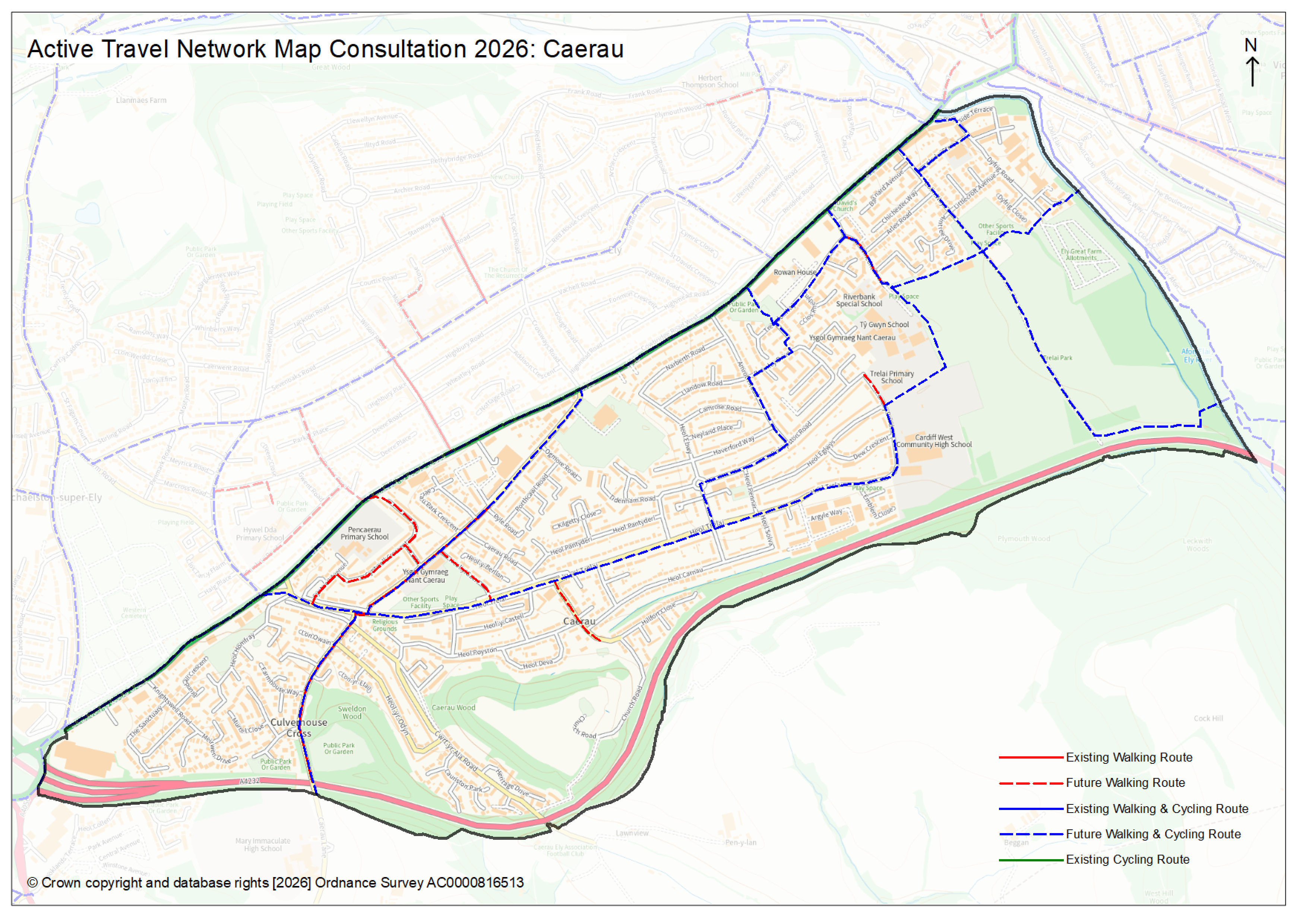
- Caerau (2mb PNG)
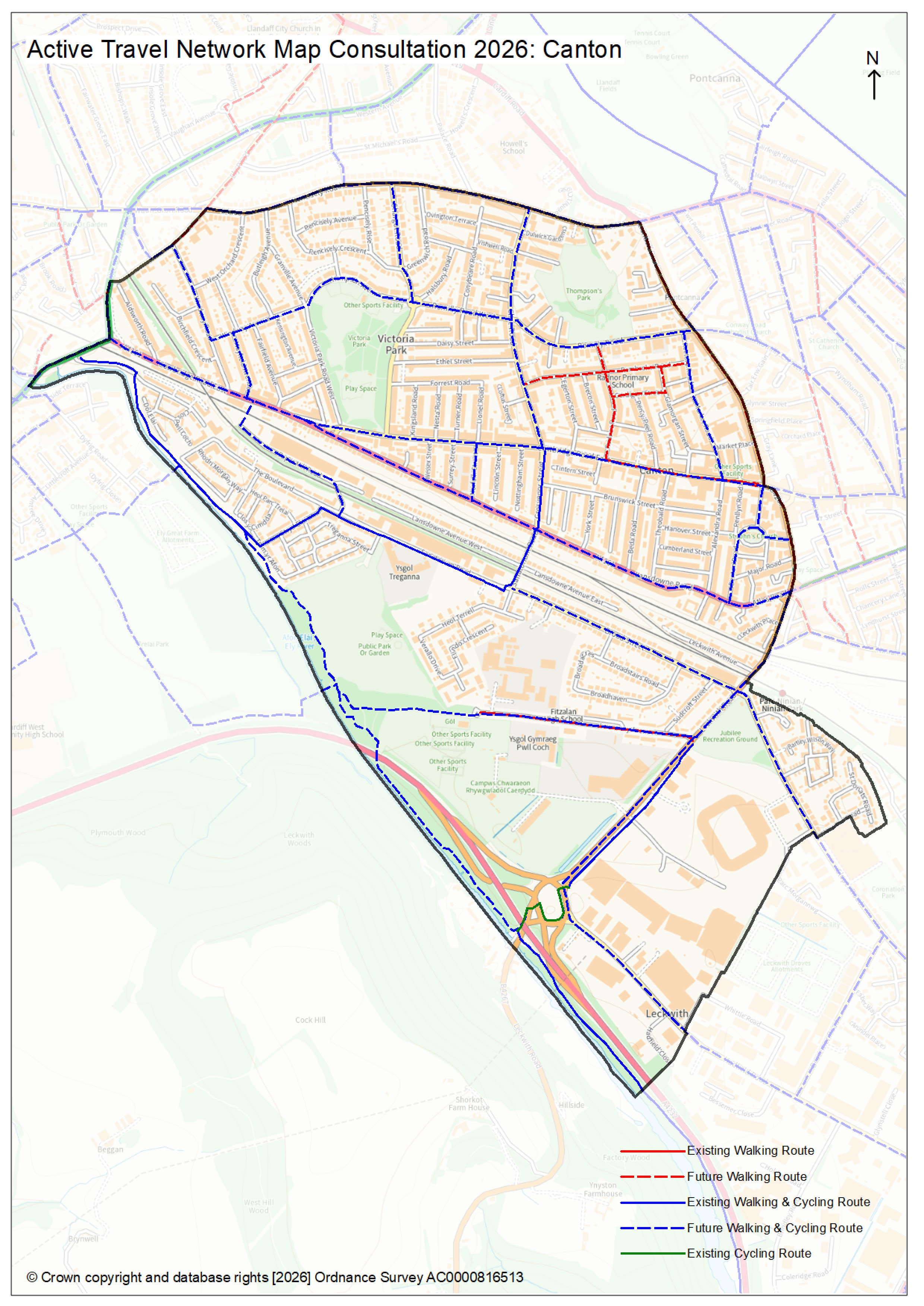
- Canton (2.1mb PNG)
- Cathays (2.6mb PNG)
- Cyncoed (2.4mb PNG)
- Ely (2mb PNG)
- Fairwater (2.3mb PNG)
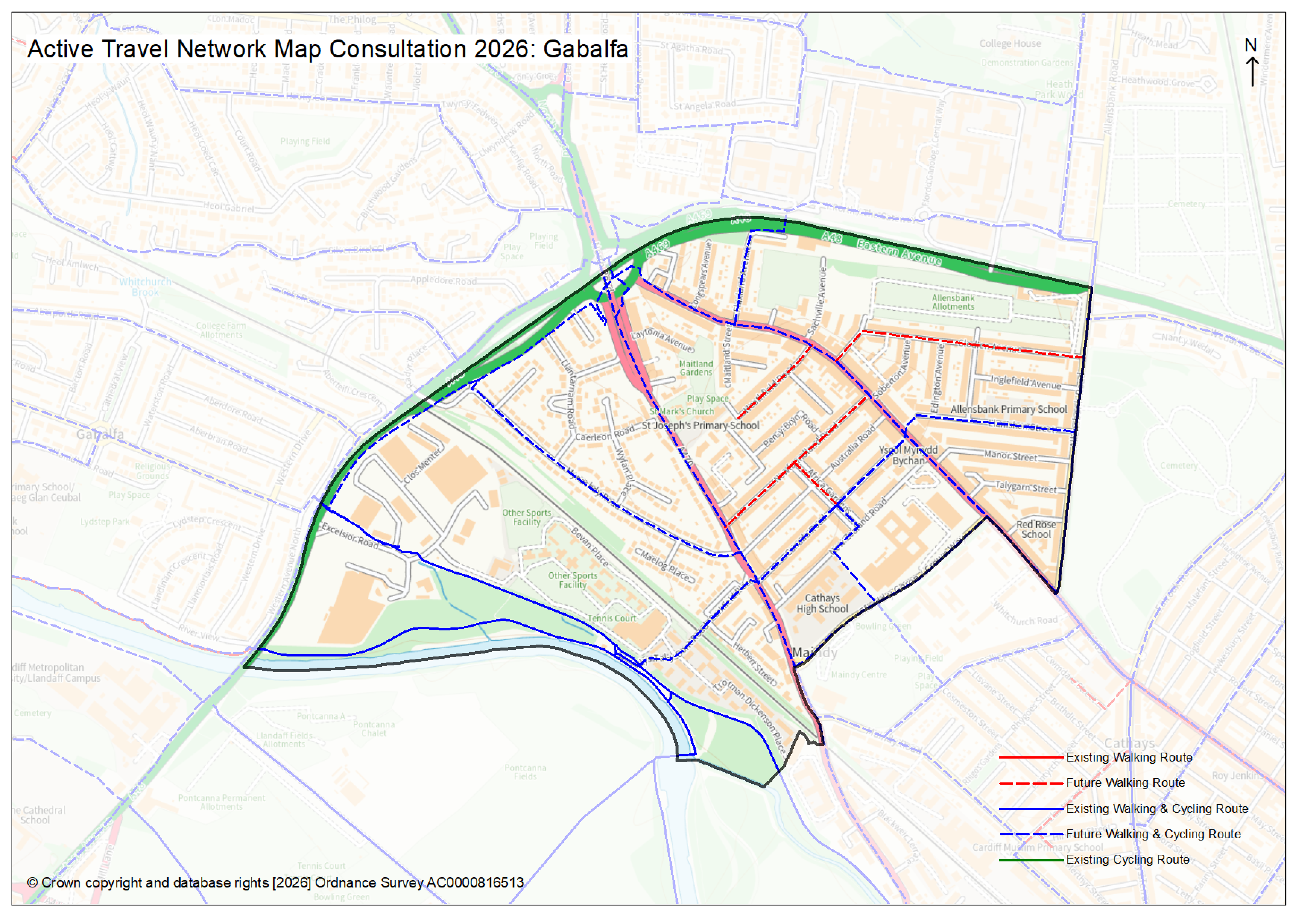
- Gabalfa (2mb PNG)
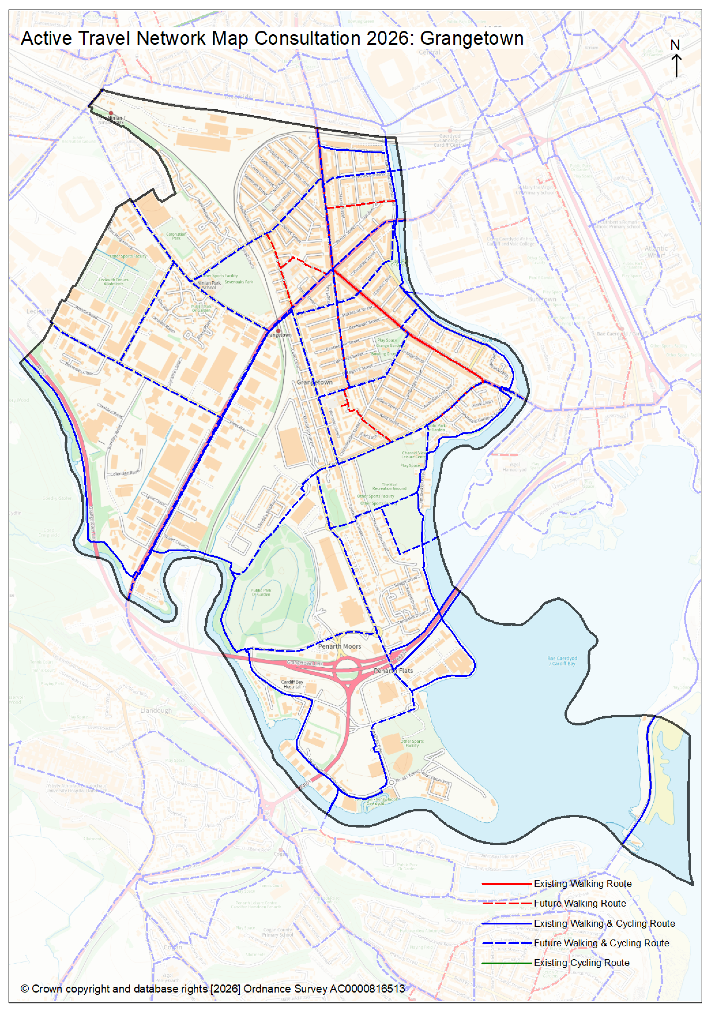
- Grangetown (2.4mb PNG)
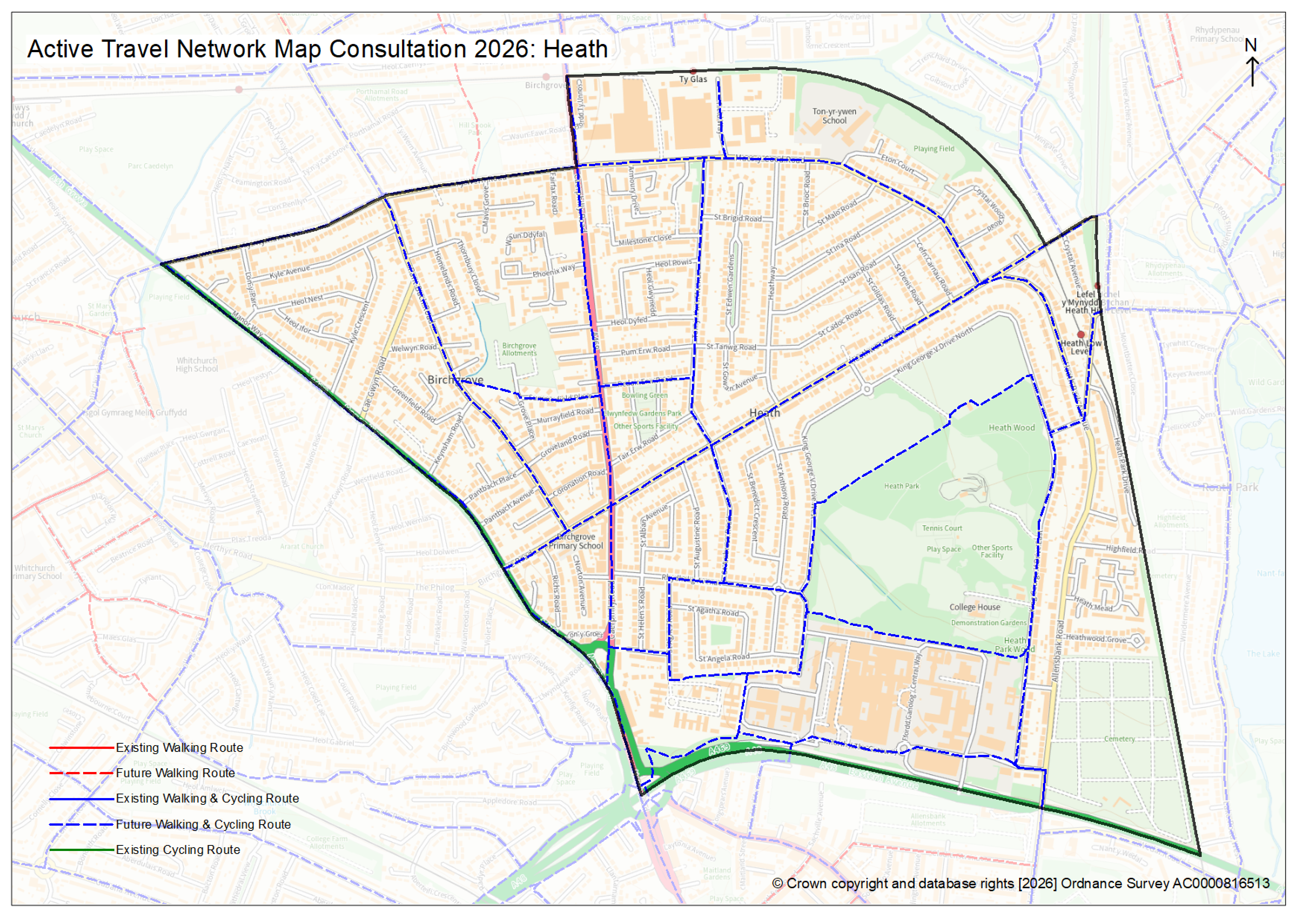
- Heath (2.3mb PNG)
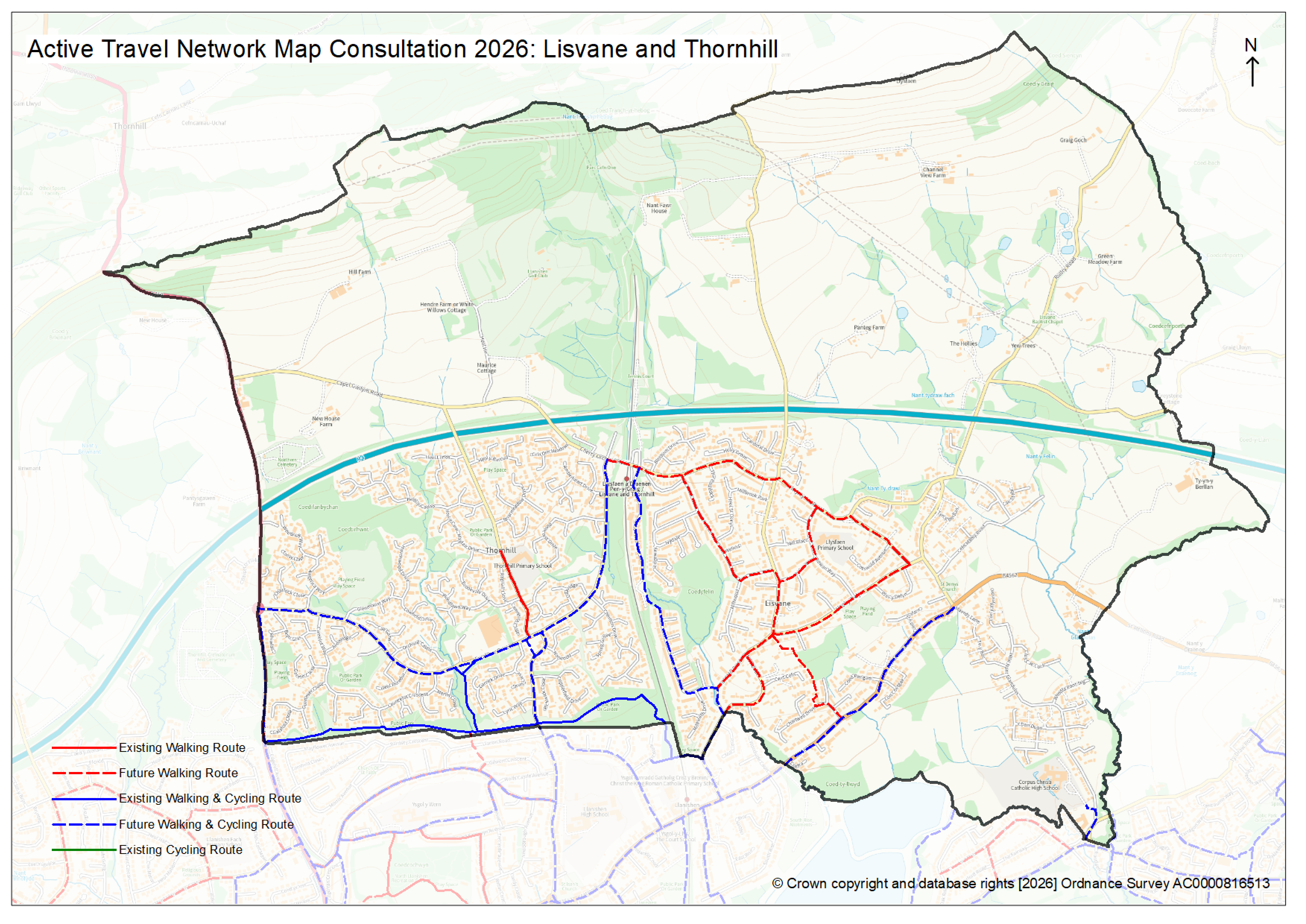
- Lisvane and Thornhill (1.9mb PNG)
- Llandaff (2.2mb PNG)
- Llandaff North (2.2mb PNG)
- Llanishen (2mb PNG)
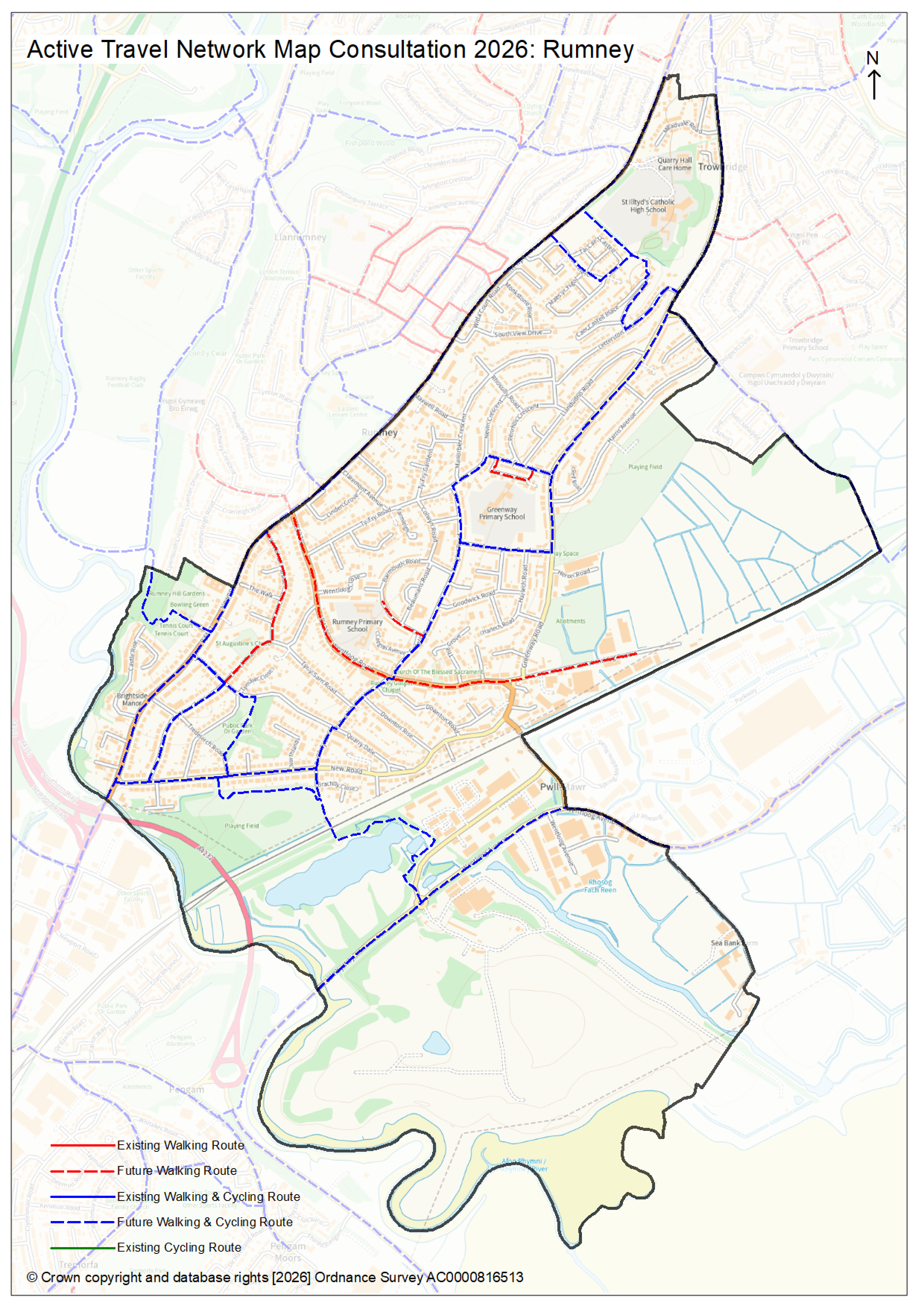
- Llanrumney (2.3mb PNG)
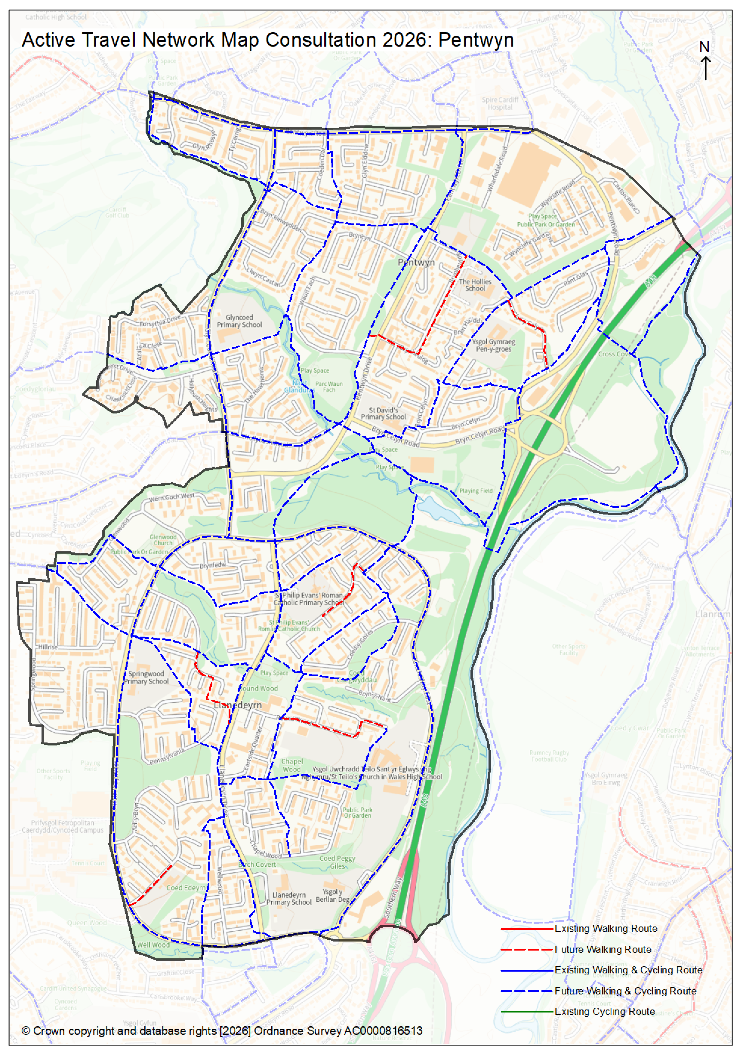
- Pentwyn (2.3mb PNG)
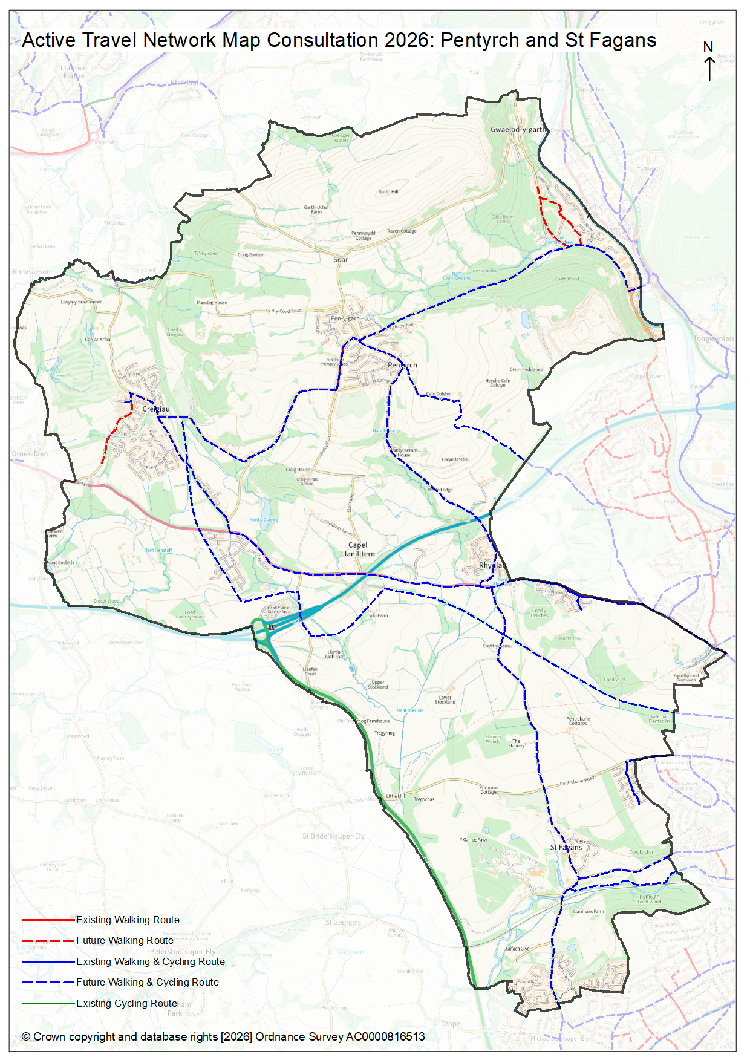
- Pentyrch and St Fagans (2.6mb PNG)
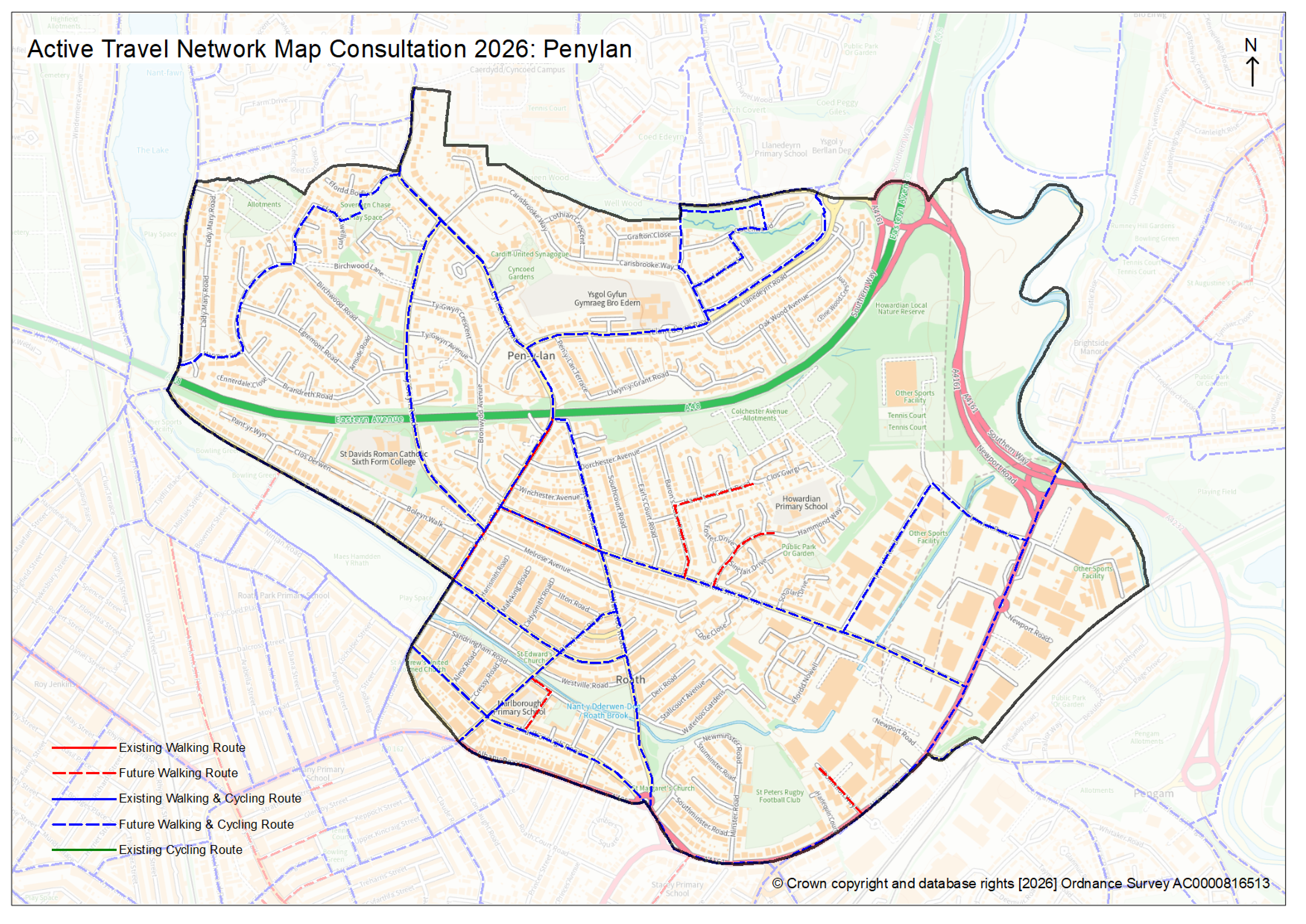
- Penylan (2.5mb PNG)
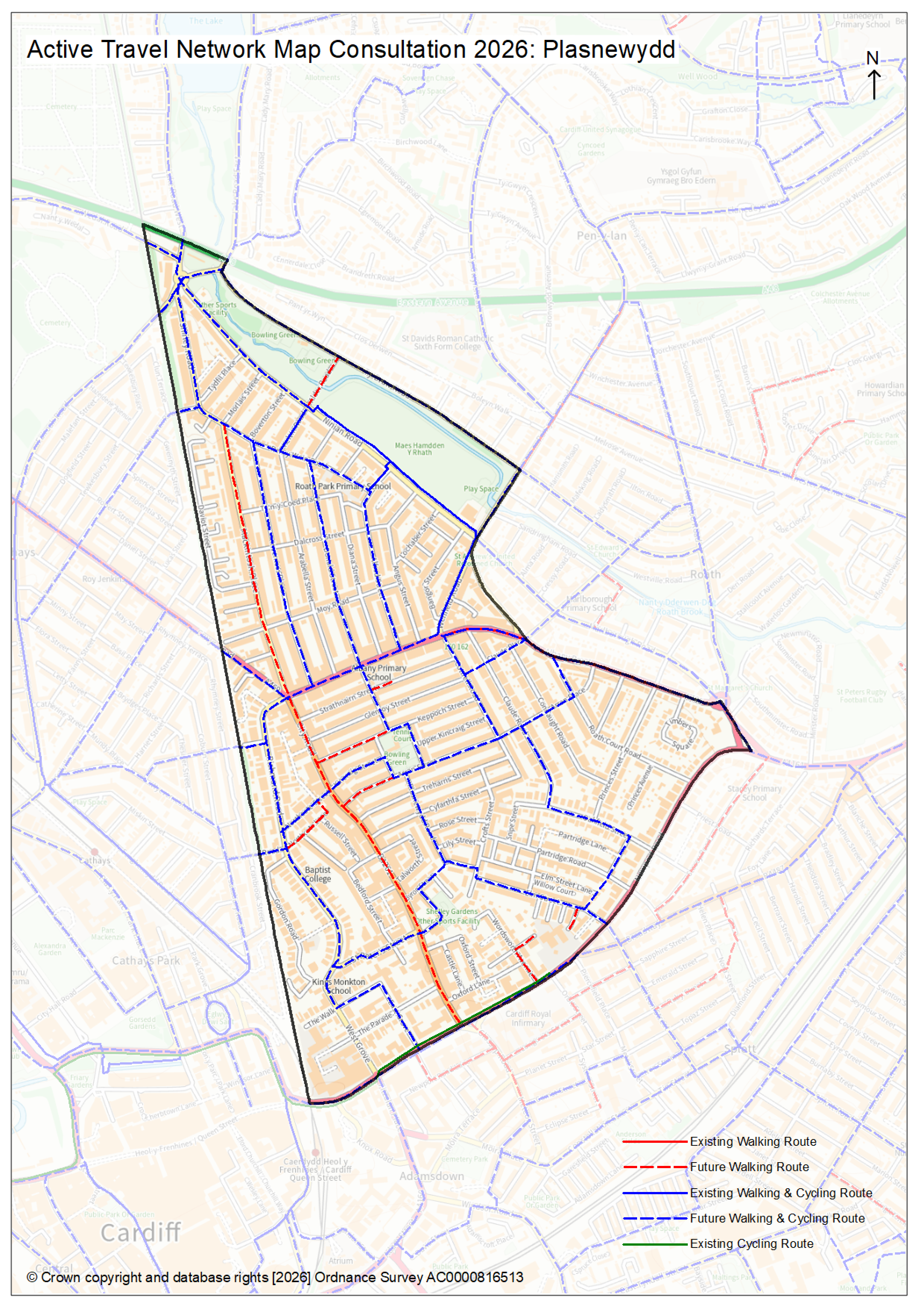
- Plasnewydd (2.7mb PNG)
- Pontprennau and Old St Mellons (2.3mb PNG)
- Radyr (2mb PNG)
- Rhiwbina (2.1mb PNG)
- Riverside (2.3mb PNG)
- Rumney (2.2mb PNG)
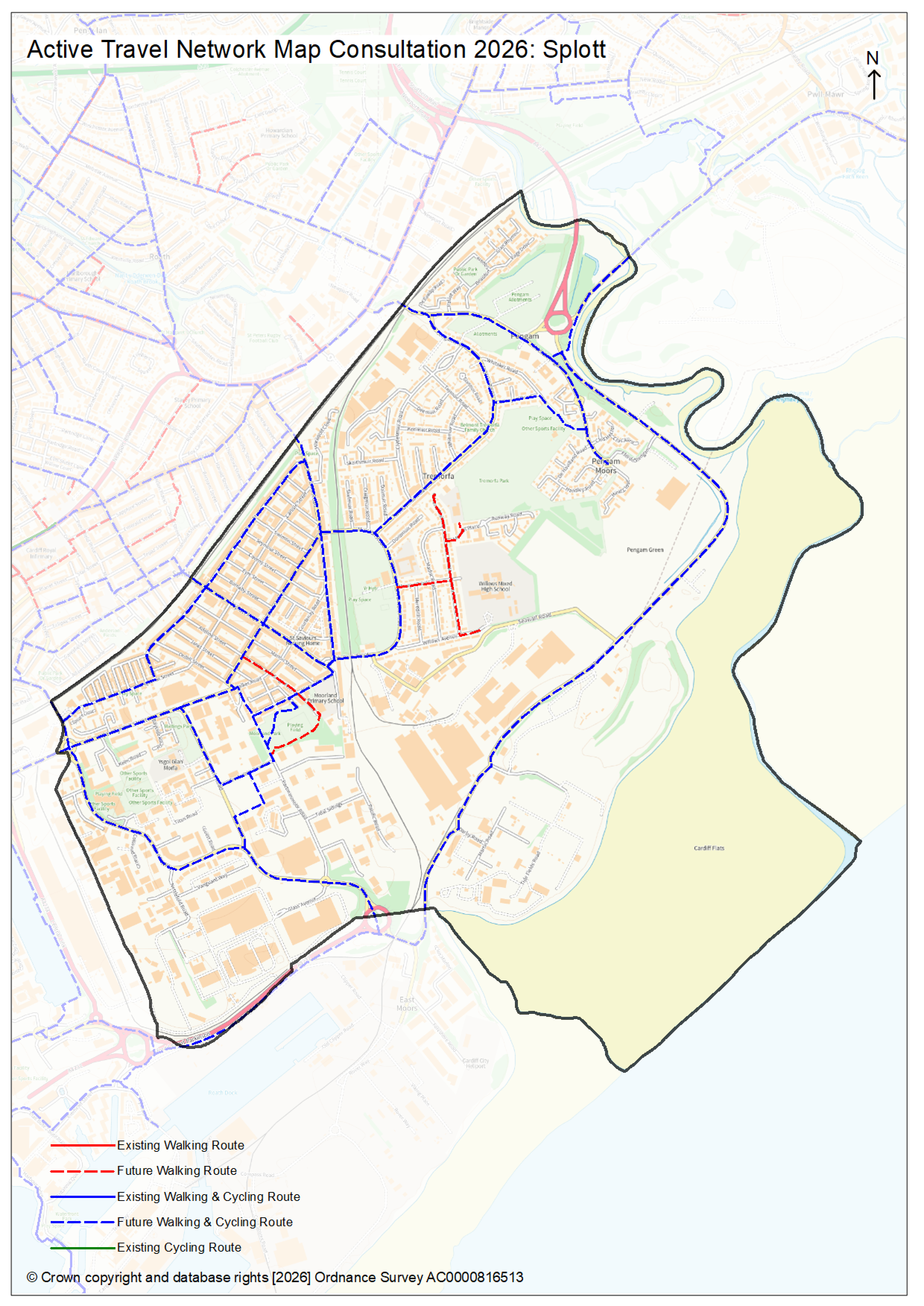
- Splott (2mb PNG)
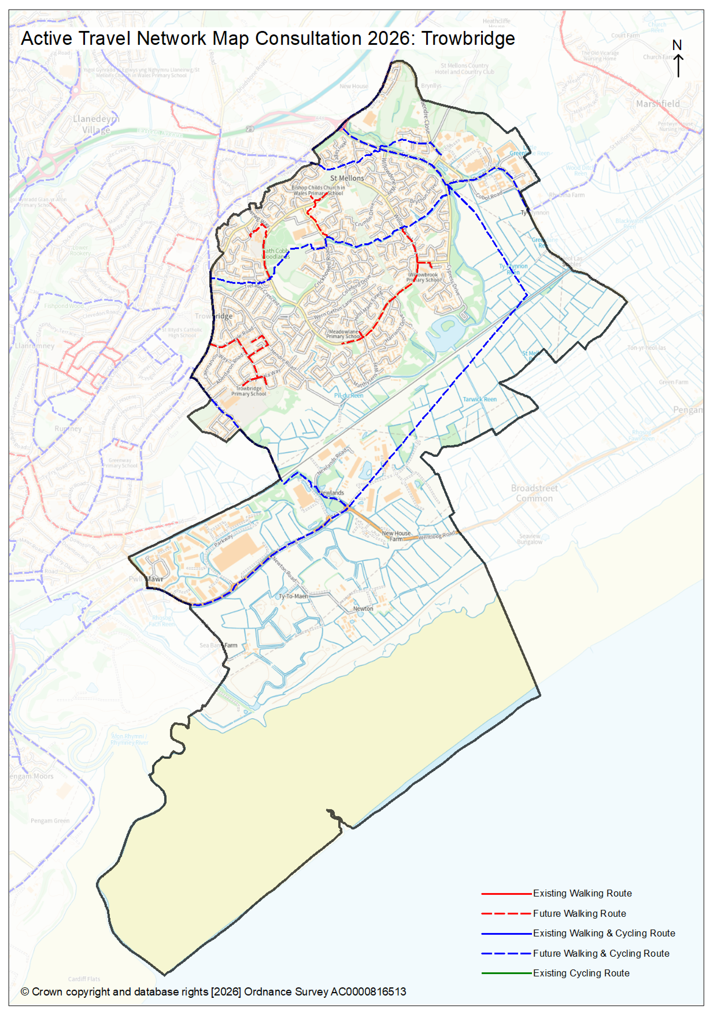
- Trowbridge (2.1mb PNG)
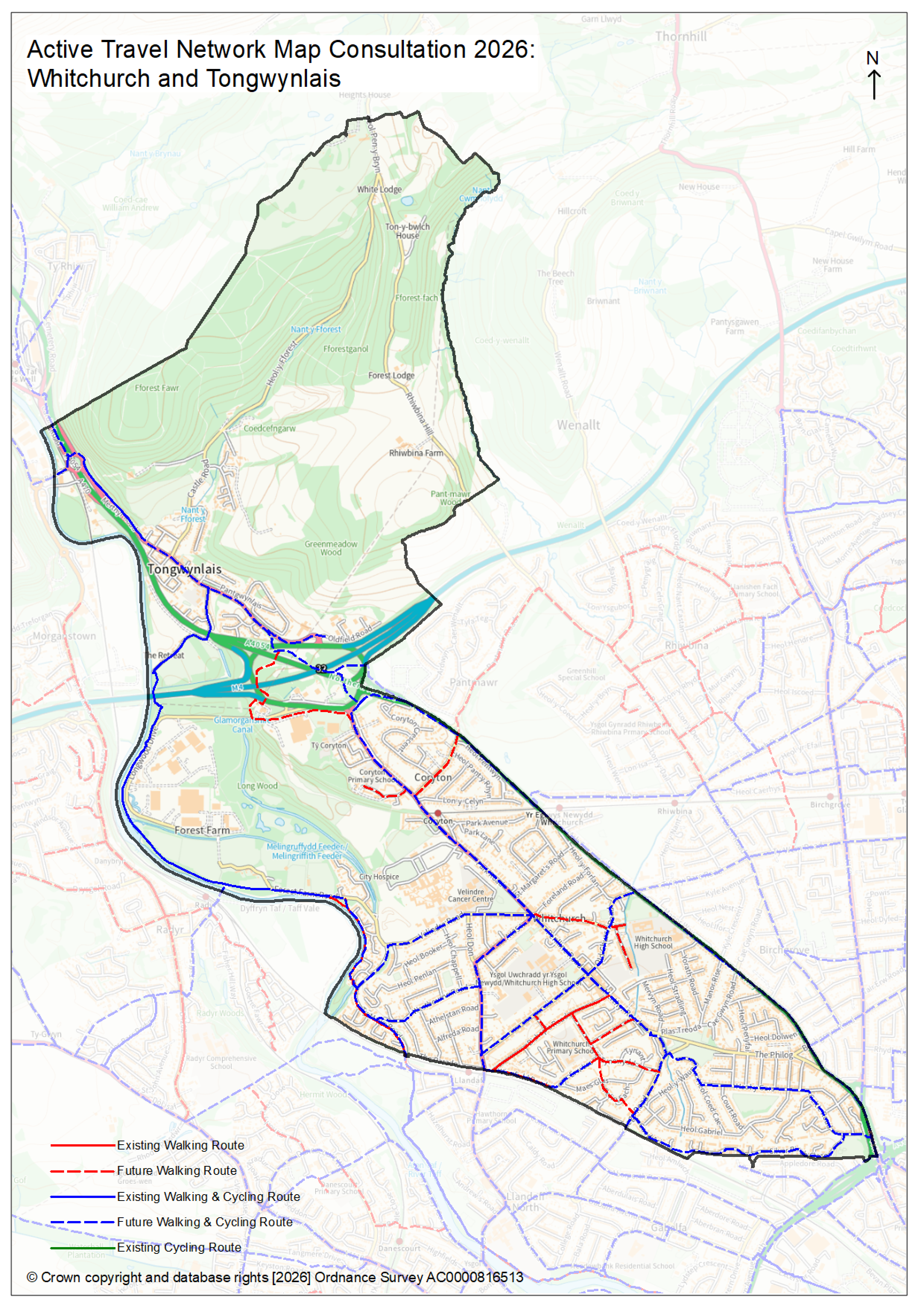
- Whitchurch and Tongwynlais (2.8mb PNG)
If you cannot access these maps or need support reading them, please contact us for more information.
Email: [email protected]
Have your say
This consultation closes on Monday 3 August.
We would like to hear your views. If you would like to make any comments, please complete the survey.
Complete the Active Travel Network Map survey
Although we cannot respond individually, we will add all raised issues to our consultation report. This will be available online or by request in future, after we close the consultation and review feedback.
Existing routes
The Active Travel Network Map shows routes which are suitable for active travel. These routes must be suitable for walking, wheeling or cycling and help people to make everyday journeys (for example to work or to school). Walking or cycling routes which are only used for leisure purposes are not active travel routes.
The quality of routes is assessed alongside Welsh Government Active Travel Design Guidance. Routes that score more than 70% are shown on the map. Routes that score between 60 and 70% are accompanied by a statement which provides more information about the issues effecting the quality of the route. Routes scoring less than 60%, or having significant issues such has high vehicle flows, narrow path widths, or lacking dropped kerbs, cannot be shown on the map.
Future routes
The Active Travel Network Map also shows future active travel routes which need to be developed or improved to create more existing active travel routes. The plan for future routes is long term (15 years or more).
The Active Travel Network Map shows the proposed alignment of future routes and whether they are proposed for walking or wheeling only, or for walking, wheeling and cycling. The Active Travel Network Map does not set out what the detailed plans are to develop these routes.
Detailed plans will be developed and consulted on as schemes are brought forward to create or improve the routes.
Prioritisation
Once the routes on the Active Travel Network Map are finalised, they will be prioritised. Prioritisation will take account of the following factors:
- Council priorities for the delivery of Cycleways
- Potential to induce modal shift from private car to walking and cycling
- Proximity to residential areas
As well as access to destinations including:
- Transport interchange
- Education
- Retail
- Leisureand tourist attractions
- Health
- Community centres, places of worship
- Impact on deprivation and health
- Safety and collision data


